
The flights east across Victoria Strait from Cambridge Bay on Victoria Island to King William Island in the early mornings, when the weather was stable, was spectacular.
 |
| Flying at 3,000 feet MSL eastbound over Victoria Strait to King William Island, 7:00 am. © 2012 - Ron Carlson (Nunavut) |
 |
| Landing and parked inland lake on KWI © 2012 - Ron Carlson (King William Island) |
 |
| Musk Ox herd near coast of Erebus Bay, KWI © 2012 - Ron Carlson (King William Island) |
Spent the past several days alternating flying and hiking a good part of the southern shore of Erebus Bay, logging about 45 miles on my handheld GPS, zig zagging on foot. Three seperate locations stood out for further investigations where I observed odd looking wooden objects from the air.
On my way on the first hike, I found very old two tent rings. In general, tent rings date as back as old as 800 to 1000 years and up to recent times. These rings are particularly intriguing because of they are on the Franklin trail. They are located along the the northern front of a small rocky enscarpment that rises only maybe 5 or 7 feet - and are placed there for a one reason - protection against the wind. But in reality, there is virtually no protection there, or anywhere here. One can see though that there was absolute attention paid to topography when they chose this location in an attempt to use any slight edge that the terrain contours might offer. This edge was practially nill, as it is with almost all the areas around here - very flat with the ocassional boulder. They are probably Inuit because they are circular. English patterns were square.
 |
| Tent ring A © 2012 - Ron Carlson (King William Island) |
 |
| Tent ring B © 2012 - Ron Carlson (King William Island) |
This was the routine for shore hiking. I was not about to land in the ocean and leave the plane with the tides. The tidal flats are fairly mucky and in some spots, boots sink to lower calfs. I kept my ankle straps loose on my hipwaders just in case that I would have ro roll out of a bad situation, which almost happened a couple of times. I found that when my foot would sink deep in a certain spot, my inclination was to accellerate forward, fast - but you have to avoid this. Best to stop and back track because many times it gets worse. And then this could possibly happen:
On July 15, 1988, a tragic accident on the mudflats of Turnagain arm near Portage, Alaska claimed the life of newlywed, Adeana Dickinson. She had become mired in the wet silt that is exposed twice every day by the outgoing tide. The ATV driven by her husband had become stuck in the mud and while pushing the vehicle, her leg sunk to her knee. Unable to free her, her husband summoned help, but it arrived too late. The incoming tide rushed in and inundated her. Hypothermia was also a factor as the water was extremely cold.
Here is a picture taken from 300 feet MSL of the typical sand / muck flat on KWI.
 |
| Tidal flat, at Erebus Bay shoreline - mid July, 2012 © 2012 - Ron Carlson (Erebus Bay, King William Island) |
Below are some pictures of those items.
 |
| Subject 1 © 2012 - Ron Carlson (King William Island) |
Most intriguing, from my notes from overflights from these same spots last year 2011, these articles were not there then. They are probbaly new. I may be wrong - but possibly pushed up by this year's pack ice.
Or I missed it all last year.
Also some other wooden objects found, one very large, very old and man made.
Or I missed it all last year.
Also some other wooden objects found, one very large, very old and man made.
.jpg) |
| Detail of subject 1 Had no tape measure, but crudely it is 8 to 9" wide by around 3" thick. © 2012 - Ron Carlson (King William Island) |
.jpg) |
| Detail of Subject 2 © 2012 - Ron Carlson (King William Island) Some type of column or post.... |
Below - It appears that this pole could be part of a mast. The rope in the middle turned out to be fur and guts from some animal and there were no unusual markings or sign of holes or places where bolts or other attachments could have been. Have to try to determine what type of wood this might be. Did not touch or turn over, perhaps there were markings on bottom.
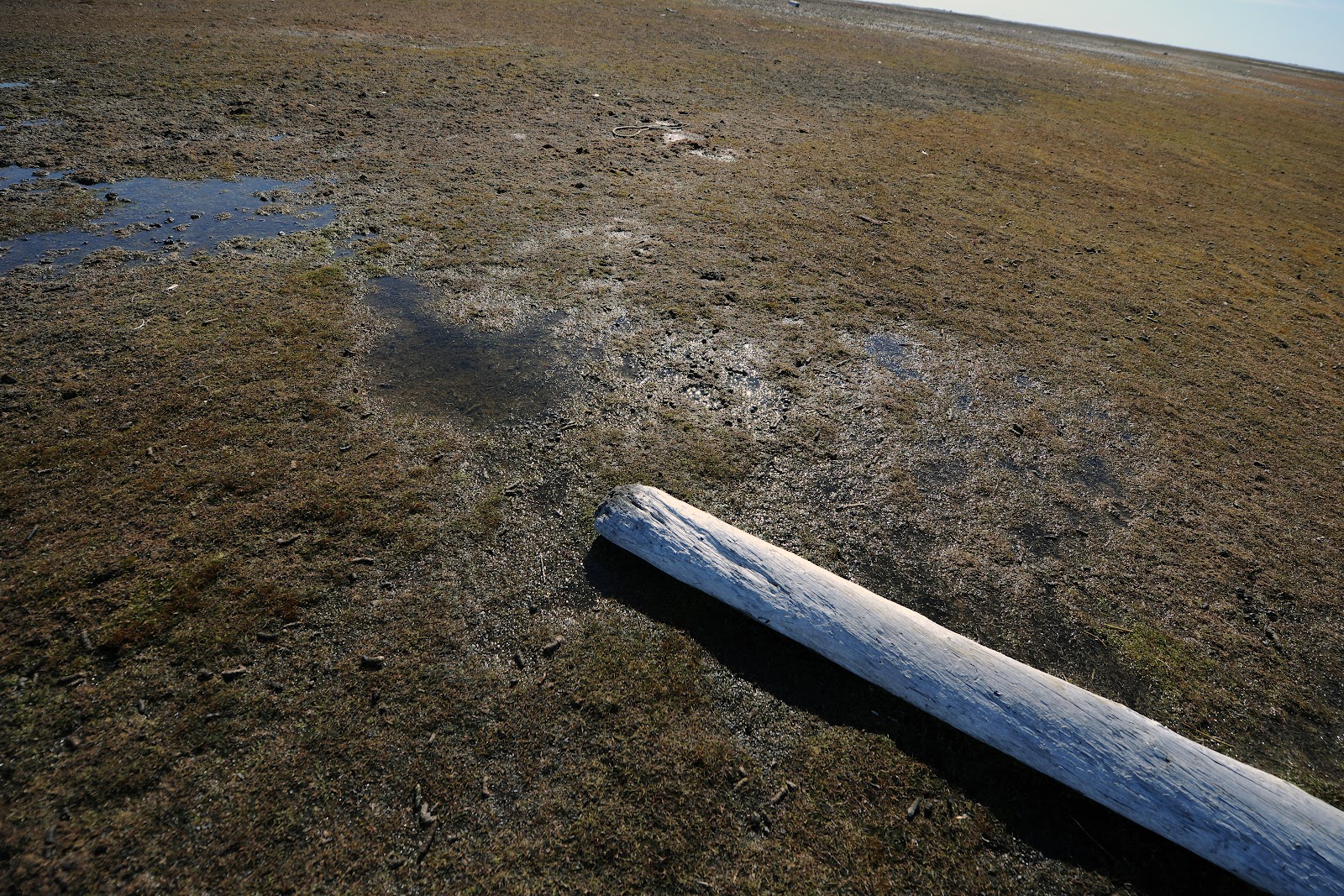 |
| Subject 3 - top end © 2012 - Ron Carlson (King William Island) |
 |
| Subject 3 - mid length © 2012 - Ron Carlson (King William Island) |
 |
| Subject 3 - almost full lenght - lighter exposure © 2012 - Ron Carlson (King William Island) |
Some videos below.

No comments:
Post a Comment